The Ozark Trails Association and Miami

Everything Else, News Events

Monte Ne, Arkansas millionaire William Hope “Coin” Harvey was a man of many visions. One need he saw was good roads in the Ozarks. Thus, he formed the Ozark Trails Association in 1913, when automobiles were starting to become common. Its goal was to promote better roads and mark them so that the public could easily find them, and tour Ozark communities without fear of impassible conditions.

The green Ozark Trails signs were soon seen along byways from New Mexico to St. Louis, and pillars were erected at significant crossroads.

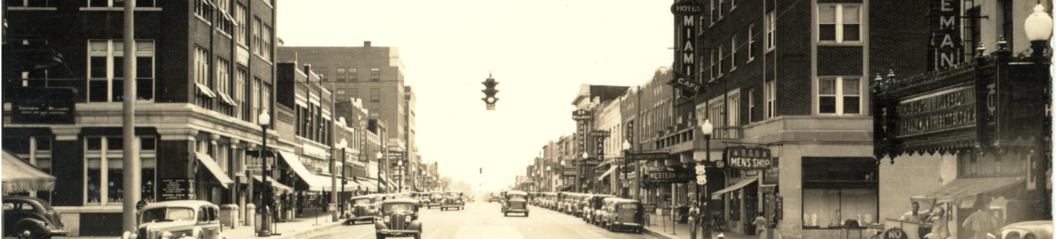
One such intersection was Miami’s Main and Central.

In June, 1918, Harvey organized a rally in Miami for the association. He urged the city to prepare for some 12,000 guests, most arriving by motorcar. A tent city was created, and the newly built Hotel Miami was filled to capacity, as were the homes of folks who rented rooms for the occasion.

Harvey suggested that Miami erect three twenty-foot solid concrete pillars: one at their main intersection, the others at the north and south ends of town, to be covered with the names and distances of other towns along the Ozark Trails route.

Thus, should Miami agree to the markers, its own name would be inscribed on other markers all across the mid-south. Harvey estimated that would amount to 300 visitors a day traveling the Ozark Trails route, specifically looking to visit Miami.

The city agreed to build the markers, but only with a concrete base, the rest of them in framed stucco. That would give the Main/Central marker an unexpected durability which would become evident the next year.

So, on June 1, 1918, the three markers were placed at the north end of Main (likely near N Third), near the entrance to Riverview Park, and downtown.

Ozark Trails pillar, shortly before it was removed in 1919. Click to enlarge

Harvey was in town the previous Thursday night, then was off to Joplin, to supervise the two monuments they were erecting.

A big concrete structure on a four foot base in the middle of Main Street. What could go wrong?

Click to enlarge

The Miami Daily Record-Herald of February 25, 1919 reported an accident. Allan R. Ward was driving his lady friend home to Commerce when he whacked the monument and knocked it a foot out of line. The tweaked appearance of the pillar in the illustration to the left suggests it might have been photographed soon afterwards.

The pillar is finally removed. Click to enlarge.

Ward blamed the accident on the curtains in his car blocking his view. Stick with that story, Mr. Ward.

Anyhow, it was determined soon afterwards that the pillar was a traffic hazard. So in April, 1919, it was arranged for a WWI tank to come to town to demolish the pillar, amid great hoopla. The occasion was used to try and drum up support for the Victory Loan of 1919, intended to pay off war costs.

A crowd of thousands watched as Tank #11 went to war with the monument, driving up its side. The monument refused to give in, however, its concrete base firmly anchoring it vertically. The tank only succeeded in pushing it around.

The attached article gives details on the pillar’s final demise. Apparently Miami learned a valuable lesson: Don’t set twenty-foot pillars in the middle of a busy road.

A Brief History of Riverview Park

Everything Else, Miami Social Activities

Trio enjoying the Neosho River in 1913

Riverview Park opening day celebration. Click to enlarge.

A park area has long existed at the extreme south end of Main Street. Photos can be seen of families at the river’s edge in the teens, just south of the first bridge to span the Neosho, very close to the present-day southern bridge’s location.

But on September 1, 1917, Riverview Park officially opened.

Possibly as early as the teens, a small pool and poolhouse was built close to the edge of the river, just north of where the east dam steps are. While flooding was less common in those days, the river did come out of its banks every few years. When discussions took place regarding the location of a huge new pool in 1929, concern was expressed that it be placed in an area less prone to flooding.

In 1923, the concrete dam was built, forming Lake Miami on the free flowing river, and causing spoonbill to gather in huge numbers at the south side, unable to swim upstream for the first time in history.

The Neosho River dam, Lake Miami, and the poolhouse as seen about 1925

A tourist camp sort of sprang up on its own at the present day site of the park on the east side of the river. These were common in towns when automobiles were becoming more commonplace. A family could park, pitch a tent, and spend the night before moving on the next morning. When the Great Depression hit, it became home to displaced folks who lost their homes. In 1930, the city announced that the tourist camp would be closed, and the folks down on their luck were force to move on.

October 7, 1930: The free city tourist camp would be closing

“A condition of disease, filth, and pilfering exists at the park now which makes a sore on an otherwise clean and healthy city” according to mayor W.L. Rush.

But the process wasn’t instant. A June 1931 editorial bemoaned the fact that transients still had tents pitched and permanent summer homes at the park, displacing residents seeking recreation.

In 1930, that huge new pool opened up, and the fact that it is still used today testifies to its amazing design and quality. Our founders didn’t foresee Pensacola Dam, otherwise they might have located the pool elsewhere, but still, it’s not common for floods to inundate it where it sits.

Article outlining the proposed site of the new city pool at Riverview Park dated April 1, 1930.

By 1932, the park was 50 acres in size, on both sides of the Neosho. Lowland grounds were left unmaintained, and improvements were made to higher areas. Four concrete tennis courts were added that year.

In 1933, an Old Settlers Reunion was held at the park. Attending were Harry Lykins, son of the town co-founder, as well as around 250 residents and their descendants who were around in 1891.

A 1934 newspaper article mentions Sunday school being held at a “big” tabernacle at the park, with expected attendance of 250. It was mentioned again in a 1935 article. But no other mentions were made of that tabernacle that I can find.

In 1937, Riverview Park was home to a small zoo run by Grove resident C.F. Tucker. The zoo had 32 animals when opened. These included a camel, llamas, elk, and reindeer.

1932 newspaper article encouraging visitors to the new city pool

The pavilion building just southwest of the swimming pool was likely built as a WPA project in the 30’s.

Riverview continued to be the city’s gathering place through the 40’s and 50’s. Land acquisitions caused it to periodically increase in size. In the early 60’s, a steel submarine was erected by the WPA-built pavilion. And in 1966, a beautiful Mid Century Modern pavilion was built.

Tug-of-war, probable location is Riverview Park, 1935

Riverview Park continues to be a treasured Miami gathering spot today. The dam, approaching 100 years old, is occasionally seen sticking out of the waters now backed up by Pensacola dam. Fishermen line its banks every spring during spoonbill season. And I’ve observed courageous young men wading the river retrieving lost hooks and sinkers, while big spoonbill bump into them in their travels. The park isn’t quite as old as the city, but will remain a part of it as long as the city lasts.

Sanborn Maps from 1896 and 1898

Everything Else

In 1896 and 1898, Sanborn drew up maps of Miami, I.T. They are presented here for your pleasure. Click on each image to see in full (huge!) resolution in a new page.

You might want to have Street Names: Old Vs. New open while exploring.

1896 map of South Main, pretty much the only part of town with buildings. Click to enlarge

Sanborn map from 1898 of SE D and 3rd area

Sanborn map from 1898 of NE 1st area

Sanborn map from 1898 of SE 1st area

Sanborn map from 1898 of NW 1st area

Sanborn map from 1898 of SW 1st area

Sanborn map from 1898 of SW 3rd area

Miami’s Bridges

Everything Else

Ferry located at the “south part of town,” 1880’s

In the beginning, there was the ferry, and the ferry was located south of town, at the “southern edge” of Miami. The ferry preceded the town itself.

“Road workers” at fording spot near NW 3rd, circa 1900

According to resident Mary Booth, born in 1898, there was also a place to ford the river under favorable conditions in the vicinity of NW 3rd. The photo above depicts this location.

Ten years after the town was incorporated (1901), a toll bridge was completed, near the present-day bridge by Riverview Park. This ended the ferry’s run. Note two bridges visible in the photo below.

1913, toll bridge and Frisco bridge in background

The Frisco railroad to Afton was also completed that year, so Miami quickly had two bridges where it had none.

Frisco bridge across the Neosho, early 20th century

This original Frisco bridge was replaced in 1943 with a span which had no trusses. It continues to exist today, although it has had improvements over the years.

In 1916, the toll bridge was purchased by Ottawa county for $10,000, and you could now cross the Neosho south of town for free.

According to The History of Ottawa County, by Velma Nieberding, the bridge was disassembled around 1920-1921 and moved to Stepp’s Ford, west of Commerce. It was demolished there in 2016.

Concrete bridge at Riverview Park, circa 1960

The disassembly of that bridge is the logical time period for the building of the concrete bridge which was there through late 1967. That bridge had arches which were prone to catching driftwood and which had to be frequently cleaned. It was replaced with a higher span with less obstruction in 1967.

In 1934, construction began on a brand new bridge at SW 3rd. On September 22, 1935, it was opened to traffic. That bridge lasted until it was replaced in 1997.

The Route 66 bridge, circa 1940

C.M. Bartlett dedicating the new Highway 66 bridge, 1937

1937 article about the new Route 66 bridge, and also a history of previous bridges. Click to enlarge

News-Record article and photo describing new Riverview Park bridge, November 1967. Four bridges are temporarily visible.

The concrete bridge depicted above was demolished shortly after the new one opened.

There’s one other bridge spanning the Neosho in Miami.

Building the M,O, and G bridge, 1912

The M O and G bridge, 2011

South of Riverview Park, around the river bend, stands the old M,O and G bridge. Originally built in 1912, it was abandoned some time in the 60’s. At presstime, it still stands.

There is now a concrete bridge at west Steve Owens Boulevard spanning the river. Thus, Miami now has two modern concrete bridges, one old railroad bridge in good repair, and one railroad bridge which has been abandoned.

Steve Gaines, Born in Miami

Everything Else

As of this publishing date, Wikipedia continues to insist that Steve Gaines was born in Seneca, Missouri. The clipping below from the Miami News-Record of September 15, 1949, should remove all doubt. This is the Miami Baptist Hospital admittance announcements. And Steve was born on September 14, 1949, of course. And note that his parents were already living on Circle Drive.

If anyone has the ability to edit the erroneous Wikipedia article, this clipping should provide conclusive proof. It can also be accessed at newspapers.com.

The Anti-Horse Thief Association

Everything Else

In 1914, cars were a rarity. The well-to-do had them, most everyone else had horses. The horse was the sole means of transportation, and to lose it to a thief would mean great inconvenience. The police did what they could do, but many thieves went unapprehended. Thus, in 1914, a vigilante group formed in Miami called the Anti-Horse Thief Association. Incidentally, the first one was formed around 1859 in Ft. Scott, Kansas.

It was a secret society, for good reason: in addition to catching thieves and turning them over to the authorities, they would sometimes dispense their own form of justice, which would typically involve a rope in a tree. Keeping the membership secret would discourage retaliation from the thieves’ friends and family. Plus, if the thieves didn’t know who the members were, they wouldn’t avoid them.

Call for an anti-thief organization to stop thefts of mining equipment, January 16, 1927

As the years went by, the group performed fewer lynchings and became less secret. A May 1930 article in the News-Record gives minutes from a group meeting in Vinita where officers were elected and named. They would post signs on properties advertising rewards of 25 to 50 dollars for the arrest and conviction of thieves of any type of property. By 1947, the national group had changed their name to the Anti-Thief Association.

By the 50’s, the group had faded away nationwide. There are still scattered branches, but they have become social clubs, not vigilante groups. Nowadays, we have Neighborhood Watch programs to keep an eye out for wrongdoers. But step back to Miami’s early years, and there was a similar organization with a lot more teeth.


Mrs. Cottam’s First Grade Class, 1965

Everything Else

This set of photos rates its own post, not because of the class picture (which is amazing, IMHO), but because of the bonus on the back: the names of the students! Unfortunately, one name is missing: the girl between Cindy Tam and Kim Kissee. It’s Jamie Swank.

Mrs. Cottam’s first grade class, Nichols Elementary, 1965-66. Click to enlarge

Mrs. Cottam’s first grade class, Nichols Elementary, 1965-66, names of students. Click to enlarge.